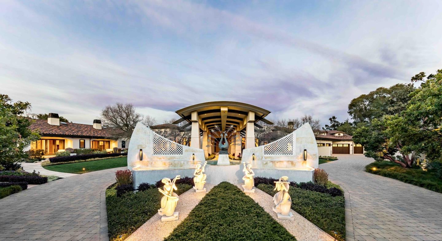
Palo Alto
A French Laundry alumnus's dining room on California Avenue, and one of only two Michelin stars in the county.
The most populous county in the Bay Area — fifteen cities on a valley floor, an estate belt along the western ridge, and working farmland at the south end that most people never see.
15
Cities & Towns
1.91M
Residents
4,265 ft
Mount Hamilton
87,000 acres
Henry Coe State Park
Bigger than it looks, and holding steady rather than growing. Santa Clara is the most populous county in the Bay Area and the sixth-most populous in California, but it sits about one percent below its 2020 census count — and San Jose has slipped back under a million residents. Nine of the fifteen cities lost population; only Santa Clara, Mountain View, Gilroy, Sunnyvale, and Morgan Hill grew. There are exactly fifteen cities and, as it happens, exactly fifteen Caltrain stations. Four separate public agencies protect well over two hundred thousand acres of open space in and around the county, which is why the valley still has visible edges. Population figures are U.S. Census Bureau estimates for July 2025.
Santa Clara County is a valley floor with mountains on three sides: the Santa Cruz Mountains along the west, the Diablo Range and Mount Hamilton to the east, and the hills above Gilroy closing the south end. San Francisco Bay tapers to nothing at the north. Everything about the market here follows from that shape.
The flat middle — San Jose, Santa Clara, Sunnyvale, Campbell, Milpitas — holds roughly 1.4 million of the county's 1.9 million people and nearly all of its post-war tract housing. The western foothills hold the estates. The south end, past the Coyote Valley greenbelt, is genuinely agricultural: row crops, vineyards, orchards, and working ranches.
It was orchards within living memory. What replaced them is the densest concentration of technology employment on earth, and both facts still show up in the housing stock and in the disclosures.
All fifteen
≈ 989,800
The county seat and California's third-largest city, now back below one million residents. Pre-war bungalows in Willow Glen and Naglee Park, vast 1950s to 70s ranch tracts across Blossom Valley, Cambrian, and Evergreen, and post-2000 mid-rise near Diridon. Enormous internal spread — Willow Glen, the Rose Garden, and Almaden trade far above the east side. Check Coyote Creek and Guadalupe River flood zones, airport noise, and bay-mud fill in Alviso and North San Jose.
≈ 156,600
1950s and 60s ranch and Eichler-era tracts, with heavy recent redevelopment of downtown and the Peery Park and Moffett Park corridors. Upper-middle of the county, and the slice of Sunnyvale inside the Cupertino school district prices meaningfully above the rest of the city. Central to the job core. Moffett Field flight noise, liquefaction on the northern bay flats, and semiconductor-era groundwater plumes are all live items here.
≈ 133,400
The county's fastest-growing city, up more than four percent since 2020 on the strength of development around Levi's Stadium. Craftsman and pre-war stock near the university, 1950s and 60s ranch through the middle, and significant new density north of 101. Mid-tier pricing that punches above its weight partly because the city owns its own electric utility. Liquefaction north of 101, airport noise on the east side.
≈ 85,400
Nationally significant Eichler enclaves in Monta Loma and Waverly Park sit beside 1950s ranch stock and a still-expanding inventory of North Bayshore and downtown multifamily. Upper-middle to high, and the Los Altos School District portion of the city trades at a clear premium over the rest. This is the most disclosure-dense city in the county: Moffett noise, bay-fill liquefaction and sea-level exposure in North Bayshore, and the Middlefield-Ellis-Whisman study area.
≈ 78,600
Mostly 1960s through 80s tract, with a large recent wave of townhomes and condos around the Great Mall and the BART station. Lower-middle of the county and the clearest value play for buyers who want rail. Its structural advantage is real: Milpitas BART opened in 2020, putting Fremont, Oakland, and San Francisco on a one-seat ride. Bay-mud fill on the western flats, 880 corridor noise.
≈ 67,600
Professorville's Craftsman and shingle-style landmarks, Old Palo Alto and Crescent Park estates, extensive 1920s to 40s Spanish and Colonial Revival, and the Green Gables and Greenmeadow Eichler tracts — Greenmeadow is on the National Register. At the very top of the county alongside Los Altos Hills, driven substantially by Palo Alto Unified. City-run utilities. San Francisquito Creek flooding on the northwest edge and baylands fill east of 101.
≈ 60,800
The southern gateway and the self-declared Garlic Capital of the World. Mostly 1970s through 2000s subdivision around a genuine Victorian-era downtown, with newer master-planned tracts on the edges. The lowest price tier in the county by a wide margin, and the most attainable entry point anywhere here. The trade is the commute: thirty-plus miles up 101, with only a handful of diesel Caltrain trains a day. Fire exposure on both edges, creek flood zones, and agricultural adjacency.
≈ 58,300
Overwhelmingly 1950s to 70s ranch on generous lots, heavily remodeled or scraped and rebuilt over two decades, plus newer density around the Apple campuses and Main Street. Upper tier, and this market is driven by school boundaries more sharply than any other city in the county — verifying the line is not optional here. Western Cupertino climbs into the foothills, which brings hillside ordinance, landslide, and elevated fire hazard zones.
≈ 45,600
1970s through 90s subdivision, newer master-planned communities, and genuine acreage and ranch property in the surrounding hills and vineyards. Lower-middle tier — below the valley cities, above Gilroy. The commute is the constraint: 101 north through the Coyote Valley bottleneck, and limited diesel Caltrain service. Wildland fire exposure in the eastern foothills toward Henry Coe, plus well and septic on rural parcels.
≈ 42,500
Compact and walkable, with a genuinely appealing downtown on Campbell Avenue, a core of 1920s to 40s bungalows, and surrounding ranch tracts now heavily remodeled. Mid-to-upper-middle, and buyers routinely cross-shop it against Willow Glen and Los Gatos as the more attainable option with similar character. VTA light rail serves downtown and the Los Gatos Creek Trail is a real amenity. Schools split across several districts, so verify.
≈ 32,600
The most complete town experience in the county: a real historic downtown, Victorian and Craftsman stock in the Almond Grove and Broadway districts, mid-century ranch on the flats, and large custom estates climbing into the Santa Cruz Mountains. Top tier, supported by the Los Gatos-Saratoga high school district and a walkable-downtown premium almost nothing else here can claim. Hillside fire hazard zones, landslide constraints, and Highway 17 noise on the western edge.
≈ 31,000
Almost entirely 1950s and 60s ranch on large flat lots, with a very high rate of teardown and rebuild producing a growing stock of large new custom homes, around a low-rise village downtown. Top tier, anchored by the Los Altos School District feeding Mountain View-Los Altos High — one of the strongest combinations in the Bay Area. Central position with quick access to 280, 85, and both job cores. Comparatively few structural hazards, though creek-adjacent flood zones apply.
≈ 30,400
Large-lot estates, mid-century custom homes, and substantial recent rebuilds on wooded parcels around a small historic village. Near the very top of the county, anchored by Saratoga Union Elementary and the Los Gatos-Saratoga high school district. No rail; Highway 85 does the work. This is a wildland-urban interface town — much of it carries elevated fire hazard severity designation under the 2025 CAL FIRE maps, and insurance availability is now a first-conversation item, not fine print.
≈ 8,400
Essentially all large-lot estate, with a one-acre minimum, no commercial zoning, no sidewalks or streetlights by design, and an extensive private pathway network instead. Contends with Palo Alto for the top of the county and is its purest luxury-estate market. School assignment varies by address across several strong districts — verify it. Budget for hillside and grading limits, landslide zones, septic on many parcels, fire hazard designation, and fire-apparatus access on long driveways.
≈ 3,500
The county's smallest city, about a square mile and a half, incorporated in 1957 specifically to protect its semi-rural character. Entirely residential with no commercial zoning at all and roughly ninety-nine percent single-family — large-lot custom and estate homes, many rebuilt in recent decades. Top tier, functionally an extension of the Los Gatos and Saratoga luxury market and served by those same districts. Hillside, landslide, and fire hazard constraints mirror its neighbors.
County-governed
Stanford sits in unincorporated county land, as does the whole Mount Hamilton range east of the valley and much of the western ridge above Saratoga and Los Gatos. Out here you are dealing with county planning rather than a city: septic and wells, private road maintenance agreements, hillside grading limits, and fire-apparatus access standards. The Coyote Valley greenbelt between San Jose and Morgan Hill is unincorporated too, and increasingly protected outright.
Populations are U.S. Census Bureau estimates for July 2025, except Monte Sereno, which falls below the publication threshold and uses the 2020 Census. City limits are not school district lines here — several cities are split among multiple elementary districts, and elementary and high school districts are separate legal entities across much of the county.
San Jose Mineta International sits three miles from downtown — extraordinarily close by big-city standards, and a genuine selling point for anyone who flies weekly. It handled more than ten and a half million passengers last year. The same runway alignment puts approach noise over North San Jose, Alviso, and parts of the Rose Garden, which is worth knowing before a showing.
Fifteen Caltrain stations run the length of the county. Everything north of Tamien has been electrified since September 2024; everything south of it — Capitol, Blossom Hill, Morgan Hill, San Martin, Gilroy — is still diesel, at roughly four trains each direction per weekday. That distinction matters enormously to South County buyers and almost no listing copy makes it.
On BART, be careful what you are told. The line currently ends at Berryessa/North San Jose and Milpitas, both open since 2020. The four-station extension through downtown San Jose to Santa Clara is under construction, with the transit agency targeting 2037 and federal oversight forecasting 2039. Any page promising it sooner is out of date.
Twelve across the county
Palo Alto
A French Laundry alumnus's dining room on California Avenue, and one of only two Michelin stars in the county.
Saratoga
Saratoga's Big Basin Way landmark, Michelin-starred for eighteen consecutive years.
San Jose
Farm-driven Mexican cooking on The Alameda, recognized by Michelin for value.
San Jose
Portuguese small plates on South First Street, in the heart of the downtown restaurant row.
Palo Alto
A Palo Alto institution on Emerson Street, and the hardest reservation on University Avenue's side streets.
Palo Alto
Intimate French cooking and a deep wine list just off Ramona Street.
Palo Alto
Californian-Indian cooking in a design-forward room in downtown Palo Alto.
Palo Alto
Italian cooking and an adjoining mercato in the old Stanford Barn.
Los Gatos
Downtown Los Gatos's Greek standard-bearer, inside Hotel Los Gatos on North Santa Cruz Avenue.
Campbell
Jeffrey Stout's long-running small-plates room on South Bascom, and the reason people drive to Campbell.
Saratoga
Not a restaurant, but the county's best dinner-and-a-concert evening, on the estate grounds above Saratoga.
Saratoga
Hillside dining and an amphitheatre with the whole valley laid out below it, May through October.
Michelin distinctions are from the 2026 Michelin Guide California. Note that Santa Clara County has just two starred restaurants; articles claiming five for “Silicon Valley” are counting San Mateo County addresses. Chez TJ in Mountain View closed in April 2026 after forty-three years, and Manresa in Los Gatos closed in 2023 — both still appear on plenty of out-of-date lists.
Santa Clara County is warmer, drier, and far sunnier than the coast on the other side of the ridge. There is almost no fog here. What there is instead is a real summer — inland afternoons well into the nineties in July and August — and a real winter, with the storms arriving in November and the hills turning green by December.
They stay green until about April, then go gold for the rest of the year. September and October are the warmest, clearest, and quietest weeks, which is also when the harvest events run at the south end of the county.
Here is what a year actually looks like across the valley.
Month by month, valley floor to ridge
January
Green hills, crisp clear days
February
Hillsides greenest, plums bloom
March
Peak green, wildflowers start
April
Still green, warm afternoons
May
Hills turning gold, first heat
June
Gold hills, hot and dry
July
Real heat, nineties inland
August
Hottest month, golden hills
September
Often the hottest days, very dry
October
Warm days, cool nights, harvest
November
First rains, hills begin greening
December
Green hills return, cold nights
Drag the slider below to move through the year
Stanford opened in 1891 on eight thousand acres of former horse farm, and effectively everything else here followed from it — the research, the companies, the capital on Sand Hill Road, and eventually the housing market. The campus itself sits in unincorporated county land rather than in Palo Alto, which surprises almost everyone.
The valley's other inheritance is less flattering and worth being straight about. The semiconductor industry cleaned silicon wafers with solvents through the 1960s and 70s, and the county now has roughly two dozen federal Superfund sites, with groundwater plumes and vapor-intrusion monitoring in parts of Mountain View, Sunnyvale, Santa Clara, and South San Jose.
It is a real disclosure item and most agents skate past it. We would rather explain it to you before you write an offer than after.
Stanford's art museum, free every day, with the largest Rodin collection outside Paris and a walkable campus around it.
A 1912 Mediterranean villa above Saratoga with galleries, redwood grounds, and a full concert and performance season.
A century-old Japanese garden in the hills above Saratoga village, open daily for strolling.
Downtown San Jose's science and technology museum, with hands-on labs, design challenges, and an IMAX theater.
Foothill open space above Cupertino with more than twenty miles of trails and a working farm, sunrise to sunset.
A paved road to a 3,486-foot summit in the Santa Cruz Mountains, with an accessible path and panoramas across the whole bay.
Private
In Santa Clara County an address does not tell you the school, and you usually have to check two districts, not one. Saratoga alone is served by four different elementary districts. Cupertino Union runs K–8 and feeds the separate Fremont Union High School District; Saratoga and Los Gatos elementary students feed the separate Los Gatos-Saratoga high school district. Districts also sprawl across city lines — Cupertino Union serves parts of six different cities. Tell us which schools matter to you and we will confirm assignment by parcel before you tour anything.
1,903,300 people live in Santa Clara , where the median age is 37.9 and the average individual income is $77,018. Data provided by the U.S. Census Bureau.
Total Population
Median Age
Population Density Population Density This is the number of people per square mile in a neighborhood.
Average individual Income
Santa Clara has 654,467 households, with an average household size of 2.85. Data provided by the U.S. Census Bureau. Here’s what the people living in Santa Clara do for work — and how long it takes them to get there. Data provided by the U.S. Census Bureau. 1,903,300 people call Santa Clara home. The population density is 1,474 and the largest age group is Data provided by the U.S. Census Bureau.
Total Population
Population Density Population Density This is the number of people per square mile in a neighborhood.
Median Age
Men vs Women
Population by Age Group
0-9 Years
10-17 Years
18-24 Years
25-64 Years
65-74 Years
75+ Years
Education Level
Total Households
Average Household Size
Average individual Income
Households with Children
With Children:
Without Children:
Marital Status
Blue vs White Collar Workers
Blue Collar:
White Collar: