Benu
★★★SoMa
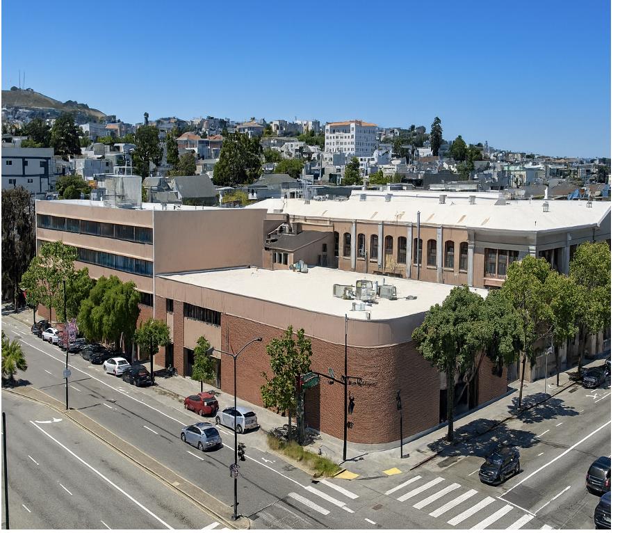
Corey Lee's three-star tasting menu on a quiet SoMa alley, widely held to be the most technically accomplished kitchen in the city.
Seven miles by seven miles, and no two blocks of it alike — a city and a county at once, where the neighborhood you choose decides your weather, your commute, and very nearly your architecture.
46.9 sq mi
Land Area
826K
Residents
39
Michelin Stars
1,017 acres
Golden Gate Park
A renter's city built on small buildings. Barely a third of San Francisco's homes are single-family, a fifth sit in two-to-four-unit buildings, and roughly half are in buildings of five units or more — which is why so much of what trades here is a flat, a condo, or a whole small building rather than a house. About 38 percent of households own. Population figures are the Census Bureau's July 2025 estimate: the city has now grown three years running, though it remains below where it stood in 2020. The Michelin count is 39 stars across 25 restaurants in the 2026 California guide, city limits only.
San Francisco is a city and a county at the same time — the only consolidated city-county in California — packed onto the tip of a peninsula measuring under forty-seven square miles of land. It is the second-densest large city in the United States, behind only New York.
What that density produces is not uniformity but the opposite. More than forty named hills break the grid into pockets, and each pocket got built at a different moment by different hands: pre-1906 Victorians west of Van Ness, Edwardian flats thrown up in the rebuild, Doelger row houses stamped across the Sunset in the thirties, residence parks laid out with landscape architects and deed restrictions, and glass towers east of Second Street that did not exist thirty years ago.
Nobody agrees how many neighborhoods there are. The Planning Department works with thirty-six. The city's own data portal maps forty-one and says plainly that those are not official boundaries. The Realtor map uses ten numbered districts subdivided into dozens more. Ask the people who live here and you will get well over a hundred. There is no official list, and that is the honest answer.
Twenty-two, north to south
Top tier
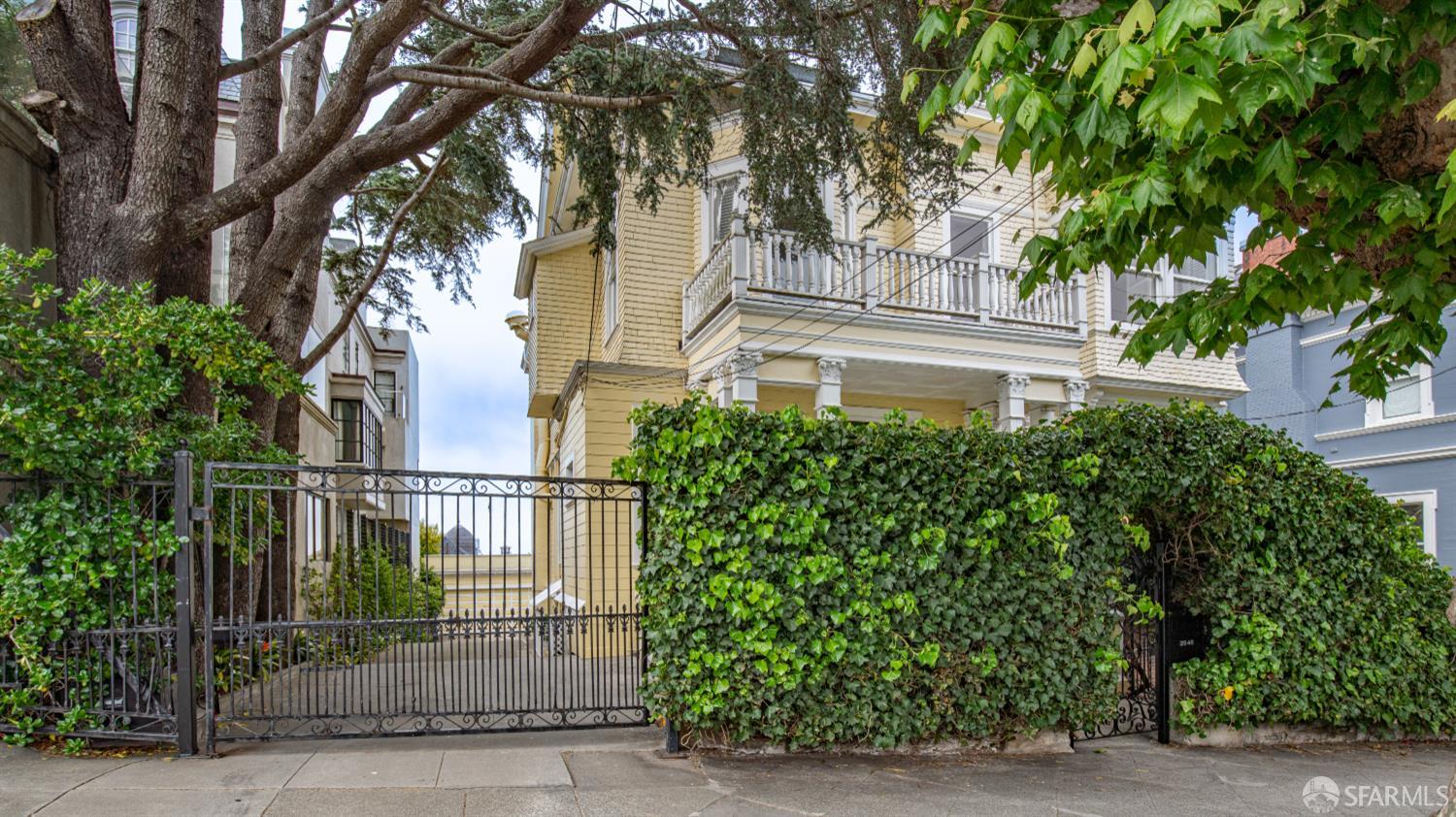
The deepest concentration of intact pre-1906 mansions in the city, because the 1906 fire was stopped at Van Ness and everything west of it lived. Fillmore Street is the corridor. Firm ground, heavily landmarked, and a finite run of Gold Coast blocks that never expands. Lower Pac Heights shifts to Edwardian flats and rent-controlled multi-unit stock.
Top tier
Quieter money than Pacific Heights, on bigger lots with more garden. Tudor, Mediterranean, and Georgian houses from the 1900s through the twenties, plus the formal residence parks at Presidio Terrace and Jordan Park. Sacramento Street for retail, the Presidio out the back door. Foggier than Pac Heights — it sits closer to the Gate.
Top tier
A 1913 residence park of Mediterranean and Period Revival houses on the bluff, with Golden Gate and open-Pacific views and China Beach inside the neighborhood. Willis Polk and Julia Morgan both built here. Inventory is tiny and comparables are thin. Lake Street below is a flatter, denser, more attainable grid of Edwardians and flats.
Top tier
The Marina is the clearest single-era neighborhood in the city — 1920s and 1930s stucco over ground-floor garages, built out after the 1915 Exposition, and the literal origin of “Marina-style.” Cow Hollow uphill is older and mixed. Chestnut and Union are two of the best retail streets anywhere in San Francisco.
Upper-mid
Edwardian walk-ups, 1920s apartment houses, and a distinct set of mid-century view towers on the crest. Polk Street below, Hyde Street above, the cable car between them. Almost entirely condo, co-op, and TIC rather than single-family — parse the ownership structure first. The spread between a view unit and a non-view unit in the same building is the whole market.
Mid
Almost entirely post-1906: the fire took the railroad barons' mansions and left only the brownstone Flood Mansion. What replaced them is the city's densest run of grand masonry apartment houses, many still operating as stock cooperatives. Two cable car lines cross at California and Powell. Board approval and co-op financing matter more here than anywhere else in the city.
Upper-mid
Rebuilt almost entirely between 1906 and 1915, which is why the fabric is so uniform: three-story flats over ground-floor storefronts, built to the sidewalk, 625 contributing buildings in the historic district. Columbus and Grant for retail, Washington Square in the middle, the Filbert Steps and the parrots above. Very rent-control-heavy, and many hill homes have stair-only access.
Mid
Jackson Square is the oldest surviving built fabric in San Francisco — Gold Rush brick and masonry that came through 1906, listed on the National Register in 1971, now full of design showrooms and galleries. The Financial District's residential stock is converted lofts and a growing office-to-residential conversion pipeline the city is actively financing. Every transit mode converges here.
Entry to mid
The condo tower belt, essentially all post-1998, with Mission Bay master-planned across 300 acres of former rail yard around the UCSF campus and Chase Center. On a per-foot basis this is the biggest relative-value story in the city right now. Underwrite the HOA dues, the reserve study, and the building's own engineering before you underwrite the unit. Post-1979 means no rent control.
Mid
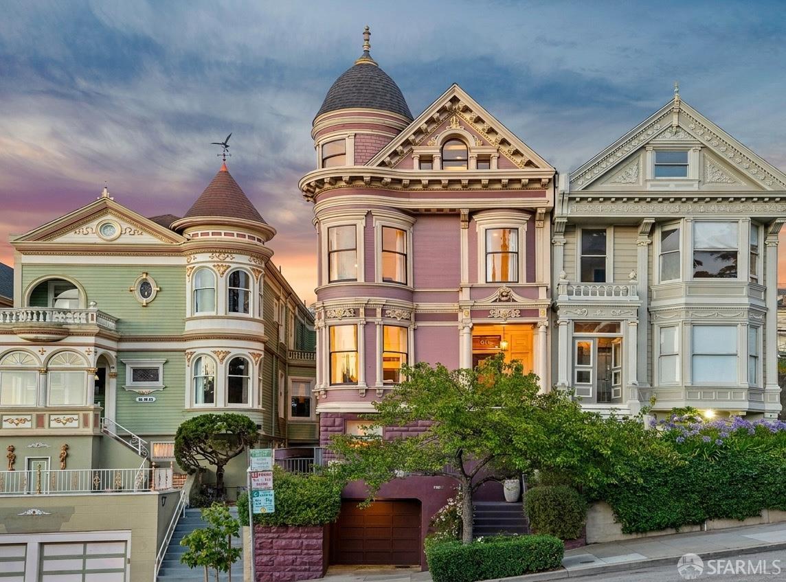
Two layers. Underneath, Victorians and Edwardians that survived 1906 — the Painted Ladies on Steiner are the most photographed houses in America. On top, twenty years of mid-rise infill on parcels freed when the Central Freeway came down and Octavia Boulevard replaced it. Hayes Street is one of the best boutique corridors in the city, with the Opera House and SFJAZZ minutes away.
Upper-mid
Dense, remarkably intact 1890s to 1910s Victorians and Edwardian flats, a great many of them speculative Fernando Nelson houses with his signature ornament. Among the sunniest parts of San Francisco, sitting in the fog shadow of Twin Peaks. Muni Metro underground plus the F-Market streetcar. Dolores Heights above adds larger houses and view property at the top of the market.
Upper-mid
The definitive family neighborhood: Victorian and Edwardian houses on a south-facing slope, with substantially more true single-family stock than the Castro or the Mission, and two decades of down-to-the-studs renovation behind it. Twenty-fourth Street is a real main street. Sunny and sheltered. Transit is the weak point — the J-Church on the edge and BART a walk downhill.
Mid
The 1906 fire was stopped near 20th and Dolores, which is why Liberty Hill holds such an intact run of pre-1906 Victorians while the northern Mission was rebuilt. Valencia and Mission Street run parallel and could not be more different. The warmest, sunniest large neighborhood in the city, and the best transit access of any residential district — two BART stations. Also the most rent-control-dense neighborhood in San Francisco: start any multi-unit purchase with the rent roll.
Mid
A hill of small cottages, modest Victorians, and stucco bungalows on streets that follow the topography instead of the grid. The highest-volume market in the city — this is where a large share of San Francisco's owner-occupant sales actually happen. Cortland Avenue is small and unpretentious, the summit has the best free view in town, and the sun is reliable. Irregular lots mean the buildable envelope varies enormously parcel to parcel.
Upper-mid
Potrero Hill is Victorians and Edwardians on a steep grid with downtown views and the best freeway access of any close-in neighborhood. Dogpatch below holds the oldest and most intact concentration of industrial workers' housing in San Francisco — a landmark district since 2003 — wrapped in new condo construction and the Pier 70 redevelopment. Among the sunniest ground in the city.
Upper-mid
Some of the finest Queen Anne and Stick-Eastlake Victorians anywhere, standing because this was west of the fire line. Cole Street is a small, excellent village corridor; Haight Street is a destination strip with everything that implies. The Panhandle and Golden Gate Park are steps away, and the N-Judah gives Cole Valley direct Metro access. A transitional fog zone — cooler than the Castro just over the hill.
Mid
Glen Park's few-block village around Diamond Street is a genuine charm asset, and Glen Canyon Park is seventy acres of wild canyon inside the city. Its BART station plus 280 access is the best transit-and-car combination in the southern half of San Francisco. Diamond Heights above is the rare mid-century district here — 1960s and 70s homes and townhouse clusters on curving streets, several HOA-governed.
Mid
Dairy land until 1906, subdivided within months of the fire and built out through the twenties as speculative rows of Edwardian flats over garages. Clement Street is the great corridor and functions as the city's second Chinatown. No neighborhood is better surrounded by open space — Golden Gate Park south, Lands End west, the Presidio north. Fog is the trade, and it is the whole reason for the price gap.
Entry to mid
Henry Doelger's neighborhood, mass-produced from the late 1920s through the forties: barrel fronts and open stairways early, then the tunnel-entrance Streamline Moderne model that everyone means by “Sunset Standard.” Garage below, living space above, every time. The N-Judah and L-Taraval give it rail access most of the west side lacks. Verify garage-level in-law permits — it is the number-one issue in Sunset transactions.
Top tier
St. Francis Wood (1912) was the first development in California with underground utilities and drew 161 different architects; Forest Hill retained John McLaren for its landscape. With Balboa Terrace, Ingleside Terraces, and Westwood Park, these are the largest houses on the largest lots in San Francisco. West Portal Avenue is a real small-town main street, and its station puts three Metro lines into the Twin Peaks Tunnel. Expect CC&Rs, HOA dues, and architectural review.
Entry
Eclectic and mostly 1900s to 1940s — cottages, bungalows, and high-style Victorians on the Excelsior slopes, more uniform 1920s and 30s stucco tract housing across Crocker-Amazon and the flats. The honest pitch is the best square-footage-per-dollar in San Francisco for a detached house with a garage and a yard. McLaren Park is the city's second-largest and radically underused. Balboa Park BART and 280 nearby.
Entry
Modest single-family houses on large lots by city standards, roughly forty percent of them predating 1950, alongside the largest development pipeline in San Francisco at India Basin and the shipyard. Frequently the sunniest neighborhood in the city, and the T-Third now runs through the Central Subway to Chinatown. It also carries the heaviest disclosure load anywhere here — shipyard environmental status and shoreline flood exposure both warrant current review.
Tier labels describe position within the San Francisco market only, and reflect where a neighborhood generally trades rather than what any individual property will fetch. Boundaries between neighborhoods are contested and unofficial — the Planning Department, the Realtor district map, and the people who live there all draw them differently.
Eight BART stations sit inside the city limits, running from Embarcadero down the Market Street spine and out through the Mission to Glen Park and Balboa Park — and straight to SFO in about half an hour. Six Muni Metro light rail lines cover the rest, joined by three cable car lines that remain the last manually operated system of their kind in the world.
Caltrain terminates at Fourth and King and has run electrified since 2024. The downtown extension that would carry it to the Salesforce Transit Center — now called The Portal — is funded and engineered but not yet under construction, with service projected for the mid-2030s. Ferries leave the Ferry Building for Marin and the East Bay all day.
The result is a city where a car is genuinely optional in a way it is not almost anywhere else in America. San Francisco and New York trade the top of the national walkability rankings back and forth year to year.
Twelve across the city
SoMa
Corey Lee's three-star tasting menu on a quiet SoMa alley, widely held to be the most technically accomplished kitchen in the city.
Jackson Square
Michael and Lindsay Tusk's three-star Relais & Châteaux dining room, in a brick landmark on Pacific Avenue.
Cow Hollow
Dominique Crenn's poetic seafood-and-vegetable tasting menu, a short walk from Union Street.
SoMa
Promoted in 2026 to become the first Mexican restaurant anywhere in the world to hold three Michelin stars.
Nob Hill
Suzette Gresham's Northern Italian institution in a converted chapel, starred continuously since the first Bay Area guide in 2007.
Mission
A two-star communal dinner party that grew out of an underground supper club, and still one of the hardest tickets in town.
Chinatown
Brandon Jew's dining room above Waverly Place — the restaurant that redefined what Chinatown fine dining could be.
Presidio Heights
Pasta-forward Californian cooking on Sacramento Street — the rare Michelin address you can walk to from home.
Dogpatch
Dogpatch's hyper-seasonal newcomer, awarded its first star in the 2026 guide.
Outer Sunset
A beach-shack bakery and bistro two blocks from Ocean Beach, and the anchor of the Judah Street strip.
Mission
Charcoal-grilled skewers and handmade soba in a room built by hand in California woodwork.
Financial District
California's oldest continuously running restaurant, still serving cioppino and mesquite-grilled fish at the original mahogany counter.
Michelin distinctions are from the 2026 Michelin Guide California. Left off only for lack of room, and worth knowing about: House of Prime Rib on Van Ness, Original Joe's on Washington Square, Swan Oyster Depot on Polk, and Zuni Café on Market.
San Francisco runs on a calendar most of the country would find backwards. The fog arrives in May, settles in for June and July, and makes those the coldest months of the year on the western half of the city. September and October are the warm ones — still, clear, fogless evenings, and the best weather San Francisco gets.
On a July afternoon the Mission can sit at seventy-five degrees while the Outer Sunset holds at fifty-eight, three miles away. Choosing a neighborhood here is partly choosing a climate, and it shows up in the prices.
Here is what a year actually looks like across the city.
Month by month, bay to ocean
January
Storm season, hills green
February
Wettest weeks, plums bloom
March
Rains taper, whales north
April
Clearest spring light
May
Wind builds, fog returns
June
Karl the Fog moves in
July
Coldest, foggiest month
August
Fog thins by afternoon
September
Warm, still, fogless
October
Warmest, clearest weeks
November
First rains, crisp light
December
Longest nights, storms
Drag the slider below to move through the year
On April 18, 1906, the fire that followed the earthquake burned for three days and took roughly eighty percent of the city. Where it stopped is written into the housing stock to this day. Crews dynamited a firebreak along Van Ness Avenue and held the line, which is why Pacific Heights still has its 1880s mansions and Nob Hill, a few blocks east, has almost nothing older than 1907. In the Mission the fire was halted near 20th and Dolores, leaving Liberty Hill's Victorians standing while the blocks north of them were rebuilt from scratch.
Everything that came after was a response. The Richmond and the Sunset were dairy land and sand dunes until refugee demand subdivided them. North Beach was rebuilt almost entirely between 1906 and 1915, which is why it looks so uniform. Read a San Francisco street carefully and it will tell you exactly which side of that line it was on.
A thousand and seventeen acres of lakes, meadows, and gardens — twenty percent larger than Central Park, with two great museums inside it.
Fifteen hundred acres of national park inside the city, with a free bluff-top park built over the bridge approach.
American, Oceanic, and African art in Golden Gate Park, with a free observation tower over the whole west side.
Seven floors of modern and contemporary art downtown, including the Fisher Collection, with a free ground floor.
An 1898 terminal holding fifty food merchants, the Ferry Plaza Farmers Market, and boats to Marin and the East Bay.
A cypress-lined coastal trail above the ruins of an 1896 bathhouse, with the best Golden Gate view in the city.
Private
San Francisco does not assign public school seats by address, and this is the single most misunderstood thing about buying here. Families rank schools across the whole district and a lottery resolves demand, with a tiebreaker preference — not a guarantee — for the attendance-area school. A zone-based policy the Board approved back in 2020 has been delayed repeatedly; as of the district's May 2026 timeline it would not take effect before the 2028–29 school year. Any listing or article telling you the zone system starts in 2026–27 is out of date. Tell us which schools matter to you and we'll walk you through how the assignment math actually works before you make an offer.
836,321 people live in San Francisco, where the median age is 40.3 and the average individual income is $90,285. Data provided by the U.S. Census Bureau.
Total Population
Median Age
Population Density Population Density This is the number of people per square mile in a neighborhood.
Average individual Income
San Francisco has 362,650 households, with an average household size of 2.267777777777778. Data provided by the U.S. Census Bureau. Here’s what the people living in San Francisco do for work — and how long it takes them to get there. Data provided by the U.S. Census Bureau. 836,321 people call San Francisco home. The population density is 24,239 and the largest age group is Data provided by the U.S. Census Bureau.
Total Population
Population Density Population Density This is the number of people per square mile in a neighborhood.
Median Age
Men vs Women
Population by Age Group
0-9 Years
10-17 Years
18-24 Years
25-64 Years
65-74 Years
75+ Years
Education Level
Total Households
Average Household Size
Average individual Income
Households with Children
With Children:
Without Children:
Marital Status
Blue vs White Collar Workers
Blue Collar:
White Collar: